Funding: SIDA Period: 1994-1997 Partners: John Norrman, Dept of Geosciences, Uppsala , Chiefs of County planning Lars-Ulrik Bergström and Örjan Molund, M. Sc. Jakob Nisell and the Staff of Natural Resources Conservation Authority, Kingston, Jamaica
Summary and general comments:
The report presents the results of the Final Phase of the Project, e.g., up to December 1997. The phase was finalised by the completion of the Manual for Integrated Coastal Planning and Management in Jamaica and the Coastal Atlas of Jamaica, which were presented at a workshop in Kingston on Dec. 4, 1997.
A basic policy of the project has been to illustrate prerequisites for a balance
between economic development and environmental considerations in the use of
coastal, terrestrial and marine, resources. Also has been emphasised in the
Terms of References the importance of enhanced public awareness and participation and the strengthening of related legal framework. The development of appropriate techniques and methodologies to facilitate planning and plan implementation is another important aspect of the project.
The Coastal Zone Management (CZM) Division of the Natural Resources Conservation Authority (NRCA) had the operational responsibility of the project. Uppsala University and its Centre for Image Analyses has served as an advisory consultant. The project has had a broad network of contact persons at all levels within the Jamaican administration . The project has also co-operated with a number of NGOs, engaged in coastal environmental issues.
The consultant's work has been carried out both in Sweden, and during short missions to Jamaica, by one or more persons each time.
The project investigations have revealed the urgent, wide need of active, creative planning of the coastal environment in order to attain a prosperous sustainable development. Some special problems that have been identified include the following items:
The fisheries, including the offshore cays, with regard to rules, methods, organisation and development of aquaculture and mareculture.
The protection and management of coral reefs and their entire ecology.
Utilisation and management of coastal wetlands.
Updating and management of sewage treatment plants.
Long term production of gravel and sand with special regard to find new sources and the necessity to optimise the use of different qualities.
In order to track the trend of water quality and other environmental variables, reliable methods and performances of sampling and analytical work have to be guaranteed.
The necessity to give Coastal Planning a firm and proper organisation has become obvious during the project. Also an increased awareness on the importance of public participation in the planning process.
Recent publications within the project:
J. O. Norrman, T. Lindell, L.U. Bergström, Ö. Mohlund and J. Nisell: Manual for Integrated coastal planning and management in Jamaica. CBA Intern rapport nr 7, 1997.
J. O. Norrman, T. Lindell, L.U. Bergström, Ö. Mohlund and J. Nisell: A Coastal Atlas of Jamaica. CBA Intern rapport nr 10, 1997.
The Manual is a significant part of the results attained by the 3-year project on Integrated Coastal Planning and Management in Jamaica, performed by the Jamaican Natural Resources Conservation Authority (NRCA), specifically its Coastal Zone Management (CZM) Division in collaboration with Uppsala University, Sweden and its Centre for Image Analysis, and sponsored by Sida. The Manual is supplemented by a separate Coastal Atlas of Jamaica.
The Manual focuses on the organisational and administrative aspects crucial to the planning process with presentations and discussions of their physical, legal, socio-economic and methodological prerequisites. It includes both compilations of existing but rather dispersed material such as memoranda, internal reports, policies etc., but also new information and original concepts.
The target groups of the Manual are individuals, groupings, organisations, parish and government authorities involved in or responsible for the management of the coast.
The Manual tries to address the issue of integrated planning and management of the coastal resources in a rather comprehensive manner without confining it to specific phases in the coastal development. The local concrete problems vary tremendously in time and space. Therefore, the document may be perceived more as a checklist and a book of reference, rather than a set of instructions to be rigidly followed step by step.
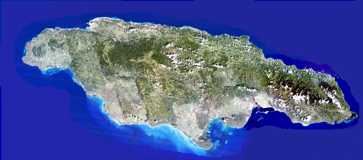
The Coastal Atlas is based upon topographic map sheets supplemented by satellite image evaulations and classification and different map layers of interest for the coastal planning and management, like land-use maps, bottom cover maps, development orders, planning zones etc.
The Coastal Atlas has also been produced in a CD format, with the addition of the Manual.
See also: http://www.nrca.org